Title:
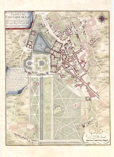
“Bourg, Chateau, et Iardins de Fontaine-Blaeu…”
Map Maker:
Nicolas de Fer
A lovely bird's-eye plan of Fontainebleau, located... (full text available to subscribers)
| Item Detail |
| |
| |
MapMaker: |
Nicolas de Fer
|
|
| |
| |
Subject: |
France |
|
| |
Period/Size: |
1708 / 16.0" x 12.5" (40.7 x 31.8 cm)
|
|
| |
Color: |
Colored
|
|
| |
Condition: |
(B ) Attractive color on watermarked paper. The map was horizontally severed in half (in between the two cartouches) but has been expertly repaired with archival materials on verso. Remargined at left with part of neatline in facsimile. (condition help) |
|
| |
Source: |
Les Beautes de la France |
|
| |
References: |
Pastoureau, Fer IV A [46]. |
|
| |
|
|
| Sales Information |
| |
| |
Price: |
|
|
| |
| |
Offered by: |
Old World Auctions |
|
| |
Catalog: |
Auction No. 141 - Antique Maps, Charts, Atlases & Globes (9037) |
|
| |
Lot/Item #: |
451 |
|
| |
| |
Date: |
09/2012
|
|
| |
| |
|
Antique Maps - Valuation and Pricing, Descriptions, Resources |
|
Home |
Information |
Search |
Register |
Contact Us |
Site Map
Americana Exchange, Inc. © 1999 - 2024 Americana Exchange, Inc.. All rights reserved.
OldMaps.com, the OldMaps.com logo and
AMPR are service marks or registered service marks of Americana Exchange, Inc..
|