Title:
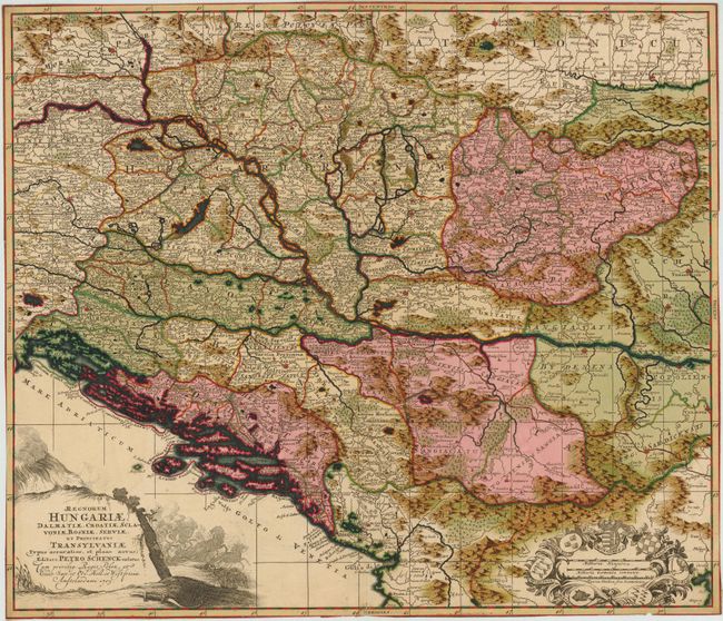
“Regnorum Hungariae, Dalmatiae, Croatiae, Sclavoniae, Bosniae, Serviae, et Principatus Transylvaniae typus acciaratior, et Plane Novus;”
Map Maker:
Petrus Schenk
The map covers present day Yugoslavia (Belgrade), ... (full text available to subscribers)
| Item Detail |
| |
| |
MapMaker: |
Petrus Schenk
|
|
| |
| |
Subject: |
Balkans |
|
| |
Period/Size: |
1705 / 18.8" x 21.8" (47.8 x 55.4 cm)
|
|
| |
Color: |
Colored
|
|
| |
Condition: |
(B ) Bold original color with a small hole near centerfold towards top, and a few short centerfold separations that have been closed on verso with archival tape. Trimmed to the neatline on all sides, with one tiny tear and one tiny chip along the sheet (condition help) |
|
| |
Source: |
|
|
| |
References: |
|
|
| |
|
|
| Sales Information |
| |
| |
Price: |
|
|
| |
| |
Offered by: |
Old World Auctions |
|
| |
Catalog: |
Auction No. 141 - Antique Maps, Charts, Atlases & Globes (9037) |
|
| |
Lot/Item #: |
542 |
|
| |
| |
Date: |
09/2012
|
|
| |
| |
|
Antique Maps - Valuation and Pricing, Descriptions, Resources |
|
Home |
Information |
Search |
Register |
Contact Us |
Site Map
Americana Exchange, Inc. © 1999 - 2024 Americana Exchange, Inc.. All rights reserved.
OldMaps.com, the OldMaps.com logo and
AMPR are service marks or registered service marks of Americana Exchange, Inc..
|