Title:
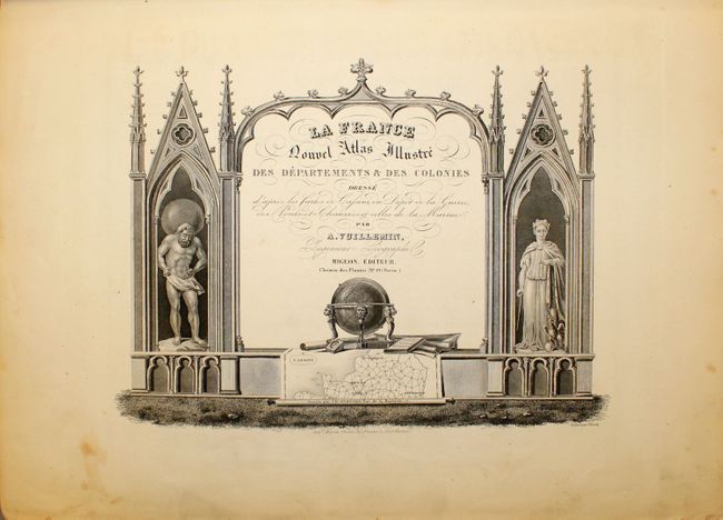
“La France et ses Colonies Atlas Illustre Cent Cartes Dressees d'Apres les Cartes de Cassini, du Depot de la Guerre, des Ponts-et-Chaussees et de la Marine...”
Map Maker:
Alexander A. Vuillemin
This apparently complete atlas of France and its c... (full text available to subscribers)
| Item Detail |
| |
| |
MapMaker: |
Alexander A. Vuillemin
|
|
| |
| |
Subject: |
France, Atlas |
|
| |
Period/Size: |
1862 / 14.5" x 11.0" (36.9 x 28.0 cm)
|
|
| |
Color: |
Colored
|
|
| |
Condition: |
(B+ ) Original color. The majority of the maps have mild toning, light offsetting, and scattered foxing. The map of Province d'Alger is completely split along the centerfold. The binding is new and in very good condition with light scuffing. (condition help) |
|
| |
Source: |
|
|
| |
References: |
|
|
| |
|
|
| Sales Information |
| |
| |
Price: |
|
|
| |
| |
Offered by: |
Old World Auctions |
|
| |
Catalog: |
Auction No. 142 - Antique Maps, Charts, Atlases & Globes (9038) |
|
| |
Lot/Item #: |
463 |
|
| |
| |
Date: |
12/2012
|
|
| |
| |
|
Antique Maps - Valuation and Pricing, Descriptions, Resources |
|
Home |
Information |
Search |
Register |
Contact Us |
Site Map
Americana Exchange, Inc. © 1999 - 2024 Americana Exchange, Inc.. All rights reserved.
OldMaps.com, the OldMaps.com logo and
AMPR are service marks or registered service marks of Americana Exchange, Inc..
|