Title:
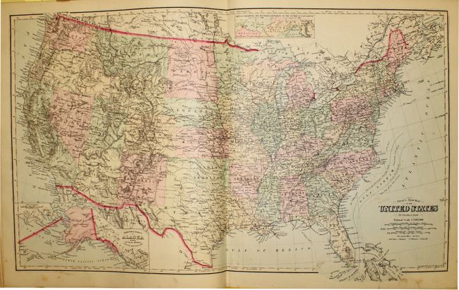
“The National Atlas, Containing Elaborate Topographical Maps of the United States and the Dominion of Canada, with Plans of Cities and General Maps of the World...”
Map Maker:
O.W & F.A Gray
This complete atlas contains 155 maps on 41 single... (full text available to subscribers)
| Item Detail |
| |
| |
MapMaker: |
O.W & F.A Gray
|
|
| |
| |
Subject: |
Atlases |
|
| |
Period/Size: |
1883 / 17.8" x 15.0" (45.3 x 38.1 cm)
|
|
| |
Color: |
Colored
|
|
| |
Condition: |
(B+ ) Text and maps are very good to fine with light scattered foxing. The hinge is starting, the spine is cracked and detached at bottom, and the covers are bumped and worn. (condition help) |
|
| |
Source: |
|
|
| |
References: |
|
|
| |
|
|
| Sales Information |
| |
| |
Price: |
|
|
| |
| |
Offered by: |
Old World Auctions |
|
| |
Catalog: |
Auction No. 141 - Antique Maps, Charts, Atlases & Globes (9037) |
|
| |
Lot/Item #: |
776 |
|
| |
| |
Date: |
09/2012
|
|
| |
| |
|
Antique Maps - Valuation and Pricing, Descriptions, Resources |
|
Home |
Information |
Search |
Register |
Contact Us |
Site Map
Americana Exchange, Inc. © 1999 - 2024 Americana Exchange, Inc.. All rights reserved.
OldMaps.com, the OldMaps.com logo and
AMPR are service marks or registered service marks of Americana Exchange, Inc..
|