Title:
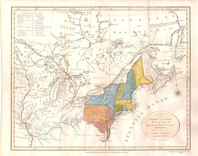
“A Map of the Northern and Middle States; Comprehending the Western Territory and the British Dominions in North America. From the Best Authorities”
Map Maker:
John Stockdale
This uncommon and information-packed map describes... (full text available to subscribers)
| Item Detail |
| |
| |
MapMaker: |
John Stockdale
|
|
| |
| |
Subject: |
Eastern Canada & United States |
|
| |
Period/Size: |
1792 / 12.5" x 15.7" (31.8 x 39.9 cm)
|
|
| |
Color: |
Colored
|
|
| |
Condition: |
(B+ ) Issued folding, now pressed with light toning along folds and a professionally repaired binding tear that enters 4" into map at right. The binding trim at bottom right has been almost invisibly replaced to accommodate framing. (condition help) |
|
| |
Source: |
Morse's Geography |
|
| |
References: |
McCorkle #792.1; Kershaw #388. |
|
| |
|
|
| Sales Information |
| |
| |
Price: |
|
|
| |
| |
Offered by: |
Old World Auctions |
|
| |
Catalog: |
Auction No. 142 - Antique Maps, Charts, Atlases & Globes (9038) |
|
| |
Lot/Item #: |
140 |
|
| |
| |
Date: |
12/2012
|
|
| |
| |
|
Antique Maps - Valuation and Pricing, Descriptions, Resources |
|
Home |
Information |
Search |
Register |
Contact Us |
Site Map
Americana Exchange, Inc. © 1999 - 2024 Americana Exchange, Inc.. All rights reserved.
OldMaps.com, the OldMaps.com logo and
AMPR are service marks or registered service marks of Americana Exchange, Inc..
|