| Item Detail |
| |
| |
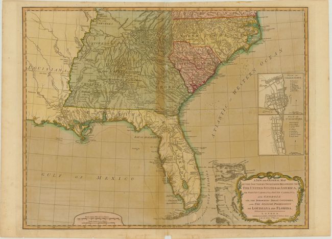
MapMaker: |
Laurie & Whittle
|
|
| |
| |
Subject: |
Southeast United States |
|
| |
Period/Size: |
1794 / 19.5" x 24.8" (49.6 x 63.0 cm)
|
|
| |
Color: |
Colored
|
|
| |
Condition: |
(B ) Full original color on watermarked paper with light offsetting, toning along centerfold, and a small chip in bottom blank margin. There are some tiny ink spots in the Atlantic, and some short centerfold separations and adjacent tiny tears that hav (condition help) |
|
| |
Source: |
|
|
| |
References: |
Tooley (Amer) pp. 98-9, #78-b. |
|
| |
|
|
| Sales Information |
| |
| |
Price: |
|
|
| |
| |
Offered by: |
Old World Auctions |
|
| |
Catalog: |
Auction No. 142 - Antique Maps, Charts, Atlases & Globes (9038) |
|
| |
Lot/Item #: |
181 |
|
| |
| |
Date: |
12/2012
|
|
| |
| |
|