Rister or Sign In to see pricing information


Title:

Map of the Southern States of North America with the Forts, Harbours & Military Positions

Map Maker:

James Wyld

Map of the Southern States of North America with the Forts, Harbours & Military Positions

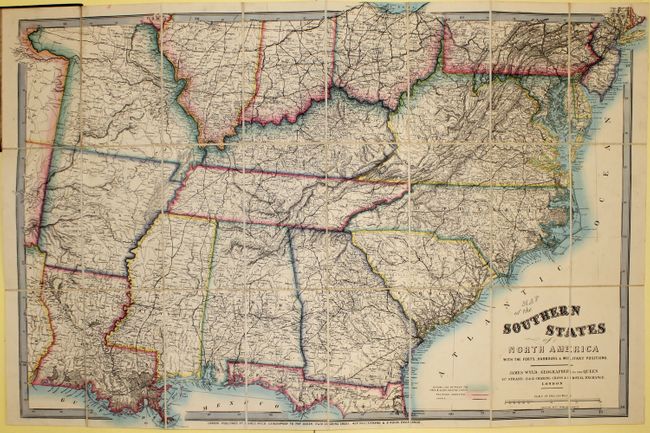
This important map indicates the dividing line ... (full text available to subscribers)
Item Detail
 
  MapMaker:  

James Wyld


  Subject:  Southern United States  
  Period/Size:  1861 / 26.5" x 39.0"  (67.4 x 99.1 cm)  
  Color:  Colored  
  Condition:  (A ) Very bright and colorful with only a few small spots in the image and a closed edge tear at top. Covers are worn with ink markings on pastedown. (condition help)  
  Source:   
  References:   
 
 
Sales Information
 
  Price: 

Please register your email to view records, or sign in with email address to see records


  Offered by:  Old World Auctions  
  Catalog:  Auction No. 142 - Antique Maps, Charts, Atlases & Globes (9038)  
  Lot/Item #:  187  
 
  Date:  12/2012  


Antique Maps - Valuation and Pricing, Descriptions, Resources


Home | Information | Search | Register | Contact Us | Site Map

Americana Exchange, Inc. © 1999 - 2024 Americana Exchange, Inc.. All rights reserved. OldMaps.com, the OldMaps.com logo and
AMPR are service marks or registered service marks of Americana Exchange, Inc..