Title:
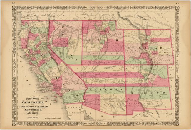
“Johnson's California, with Utah, Nevada, Colorado, New Mexico, and Arizona”
Map Maker:
Johnson & Ward
This is an early edition in this great series of m... (full text available to subscribers)
| Item Detail |
| |
| |
MapMaker: |
Johnson & Ward
|
|
| |
| |
Subject: |
Southwestern United States |
|
| |
Period/Size: |
1863 / 17.0" x 23.5" (43.2 x 59.7 cm)
|
|
| |
Color: |
Colored
|
|
| |
Condition: |
(B ) Short centerfold separations at top and bottom along with two edge tears at top that just enter the border have all been closed with archival tape on verso. There is light toning, a few small chips in the bottom blank margin, and a damp stain in t (condition help) |
|
| |
Source: |
Illustrated Family Atlas |
|
| |
References: |
|
|
| |
|
|
| Sales Information |
| |
| |
Price: |
|
|
| |
| |
Offered by: |
Old World Auctions |
|
| |
Catalog: |
Auction No. 142 - Antique Maps, Charts, Atlases & Globes (9038) |
|
| |
Lot/Item #: |
206 |
|
| |
| |
Date: |
12/2012
|
|
| |
| |
|
Antique Maps - Valuation and Pricing, Descriptions, Resources |
|
Home |
Information |
Search |
Register |
Contact Us |
Site Map
Americana Exchange, Inc. © 1999 - 2024 Americana Exchange, Inc.. All rights reserved.
OldMaps.com, the OldMaps.com logo and
AMPR are service marks or registered service marks of Americana Exchange, Inc..
|