Title:
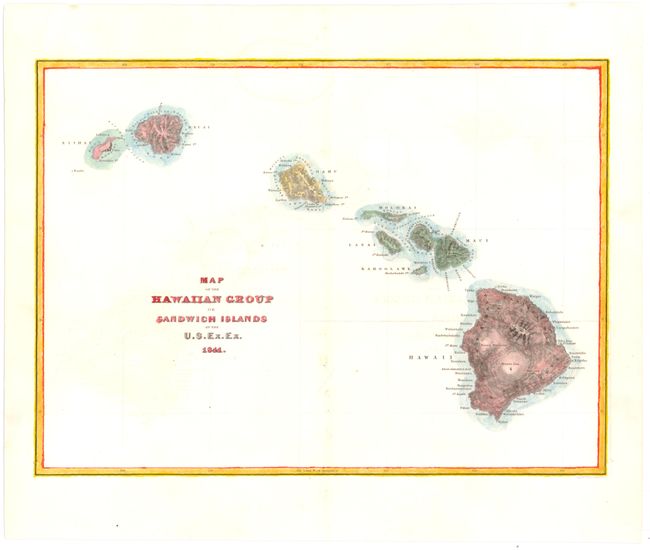
“Map of the Hawaiian Group or Sandwich Islands by the U.S. Ex. Ex.”
Map Maker:
Charles Wilkes
A large scale scientific investigation of the Haw... (full text available to subscribers)
| Item Detail |
| |
| |
MapMaker: |
Charles Wilkes
|
|
| |
| |
Subject: |
Hawaii |
|
| |
Period/Size: |
1841 / 8.3" x 11.4" (21.1 x 29.0 cm)
|
|
| |
Color: |
Colored
|
|
| |
Condition: |
(B ) Faint offsetting and toning along the centerfold with several light damp stains. Four wormholes in border have been repaired with paper. (condition help) |
|
| |
Source: |
U.S. Exploring Expedition |
|
| |
References: |
Fitzpatrick #88. |
|
| |
|
|
| Sales Information |
| |
| |
Price: |
|
|
| |
| |
Offered by: |
Old World Auctions |
|
| |
Catalog: |
Auction No. 142 - Antique Maps, Charts, Atlases & Globes (9038) |
|
| |
Lot/Item #: |
236 |
|
| |
| |
Date: |
12/2012
|
|
| |
| |
|
Antique Maps - Valuation and Pricing, Descriptions, Resources |
|
Home |
Information |
Search |
Register |
Contact Us |
Site Map
Americana Exchange, Inc. © 1999 - 2024 Americana Exchange, Inc.. All rights reserved.
OldMaps.com, the OldMaps.com logo and
AMPR are service marks or registered service marks of Americana Exchange, Inc..
|