Rister or Sign In to see pricing information


Title:

Map and Profile of the Gettysburg Rail Road. as Surveyed by Order of the Legislature of Pennsylvania

Map Maker:

Government Maps: Local & State

Map and Profile of the Gettysburg Rail Road. as Surveyed by Order of the Legislature of Pennsylvania

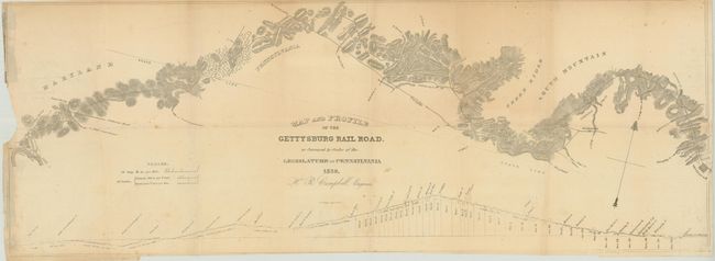
This early railroad map shows the Gettysburg Rail ... (full text available to subscribers)
Item Detail
 
  MapMaker:  

Government Maps: Local & State


  Subject:  Pennsylvania  
  Period/Size:  1839 / 12.0" x 33.0"  (30.5 x 83.9 cm)  
  Color:  Black & White  
  Condition:  (B ) Issued folding with some minor loss at left in an unengraved area, a few minor spots of foxing, and some light toning. (condition help)  
  Source:   
  References:   
 
 
Sales Information
 
  Price: 

Please register your email to view records, or sign in with email address to see records


  Offered by:  Old World Auctions  
  Catalog:  Auction No. 142 - Antique Maps, Charts, Atlases & Globes (9038)  
  Lot/Item #:  264  
 
  Date:  12/2012  


Antique Maps - Valuation and Pricing, Descriptions, Resources


Home | Information | Search | Register | Contact Us | Site Map

Americana Exchange, Inc. © 1999 - 2024 Americana Exchange, Inc.. All rights reserved. OldMaps.com, the OldMaps.com logo and
AMPR are service marks or registered service marks of Americana Exchange, Inc..