Title:
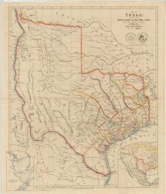
“Map of Texas, Compiled from Surveys Recorded in the Land Office of Texas, and other Official Surveys”
Map Maker:
John Arrowsmith
This is the second edition of this scarce and impo... (full text available to subscribers)
| Item Detail |
| |
| |
MapMaker: |
John Arrowsmith
|
|
| |
| |
Subject: |
Texas |
|
| |
Period/Size: |
1841 / 24.0" x 19.8" (61.0 x 50.3 cm)
|
|
| |
Color: |
Colored
|
|
| |
Condition: |
(B+ ) Original outline color with very light toning along centerfold and a small spot in title. A 1/2" tear and abrasion in top border has been professionally repaired with a minor amount of border in facsimile. There is a small area in bottom blank ma (condition help) |
|
| |
Source: |
London Atlas |
|
| |
References: |
cf Streeter (TX) #1373 & #1385; Tooley (MCC-69) #262; Martin & Martin #32; Wheat (TMW) #451. |
|
| |
|
|
| Sales Information |
| |
| |
Price: |
|
|
| |
| |
Offered by: |
Old World Auctions |
|
| |
Catalog: |
Auction No. 142 - Antique Maps, Charts, Atlases & Globes (9038) |
|
| |
Lot/Item #: |
273 |
|
| |
| |
Date: |
12/2012
|
|
| |
| |
|
Antique Maps - Valuation and Pricing, Descriptions, Resources |
|
Home |
Information |
Search |
Register |
Contact Us |
Site Map
Americana Exchange, Inc. © 1999 - 2024 Americana Exchange, Inc.. All rights reserved.
OldMaps.com, the OldMaps.com logo and
AMPR are service marks or registered service marks of Americana Exchange, Inc..
|