Title:
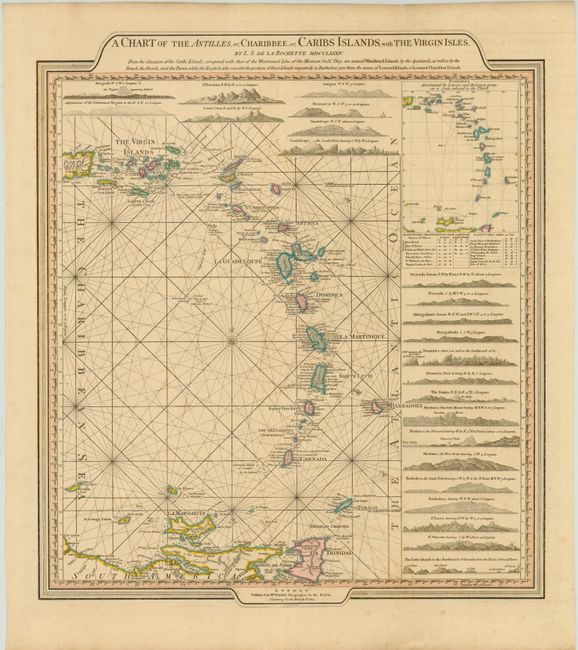
“A Chart of the Antilles, or, Charibbee, or, Caribs Islands, with the Virgin Isles”
Map Maker:
Louis Stanislas d'Arcy Delarochette
A nicely laid out chart of the islands, surrounded... (full text available to subscribers)
| Item Detail |
| |
| |
MapMaker: |
Louis Stanislas d'Arcy Delarochette
|
|
| |
| |
Subject: |
Lesser Antilles |
|
| |
Period/Size: |
1784 / 20.5" x 18.0" (52.1 x 45.8 cm)
|
|
| |
Color: |
Colored
|
|
| |
Condition: |
(B+ ) Original color with faint offsetting and a few minor spots. (condition help) |
|
| |
Source: |
General Atlas |
|
| |
References: |
|
|
| |
|
|
| Sales Information |
| |
| |
Price: |
|
|
| |
| |
Offered by: |
Old World Auctions |
|
| |
Catalog: |
Auction No. 142 - Antique Maps, Charts, Atlases & Globes (9038) |
|
| |
Lot/Item #: |
337 |
|
| |
| |
Date: |
12/2012
|
|
| |
| |
|
Antique Maps - Valuation and Pricing, Descriptions, Resources |
|
Home |
Information |
Search |
Register |
Contact Us |
Site Map
Americana Exchange, Inc. © 1999 - 2024 Americana Exchange, Inc.. All rights reserved.
OldMaps.com, the OldMaps.com logo and
AMPR are service marks or registered service marks of Americana Exchange, Inc..
|