Rister or Sign In to see pricing information


Title:

Isle St. Vincent Levee en 1773. Apres le Traite Fait avec les Caraibes

Map Maker:

George Louis Le Rouge

Isle St. Vincent Levee en 1773. Apres le Traite Fait avec les Caraibes

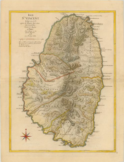
This handsome copperplate map of St. Vincent is th... (full text available to subscribers)
Item Detail
 
  MapMaker:  

George Louis Le Rouge


  Subject:  St. Vincent  
  Period/Size:  1778 / 23.8" x 18.0"  (60.5 x 45.8 cm)  
  Color:  Colored  
  Condition:  (B+ ) Printed on sturdy, watermarked paper with light offsetting and minor soiling. (condition help)  
  Source:  Pilot Americain 2.e Partie  
  References:  Shirley (BL Atlases) #M.LER-2a [31].  
 
 
Sales Information
 
  Price: 

Please register your email to view records, or sign in with email address to see records


  Offered by:  Old World Auctions  
  Catalog:  Auction No. 142 - Antique Maps, Charts, Atlases & Globes (9038)  
  Lot/Item #:  340  
 
  Date:  12/2012  


Antique Maps - Valuation and Pricing, Descriptions, Resources


Home | Information | Search | Register | Contact Us | Site Map

Americana Exchange, Inc. © 1999 - 2024 Americana Exchange, Inc.. All rights reserved. OldMaps.com, the OldMaps.com logo and
AMPR are service marks or registered service marks of Americana Exchange, Inc..