| Item Detail |
| |
| |
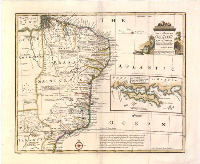
MapMaker: |
Emanuel Bowen
|
|
| |
| |
Subject: |
Brazil |
|
| |
Period/Size: |
1744 / 13.8" x 16.8" (35.1 x 42.7 cm)
|
|
| |
Color: |
Colored
|
|
| |
Condition: |
(B+ ) Issued folding with light toning along folds and a 3/16" hole west of Paraiba that has been professionally repaired. The folds have been reinforced with Japanese tissue on verso. (condition help) |
|
| |
Source: |
A Complete System of Geography… |
|
| |
References: |
McCorkle (18th c. Geography Books) #17-22. |
|
| |
|
|
| Sales Information |
| |
| |
Price: |
|
|
| |
| |
Offered by: |
Old World Auctions |
|
| |
Catalog: |
Auction No. 142 - Antique Maps, Charts, Atlases & Globes (9038) |
|
| |
Lot/Item #: |
365 |
|
| |
| |
Date: |
12/2012
|
|
| |
| |
|