Title:
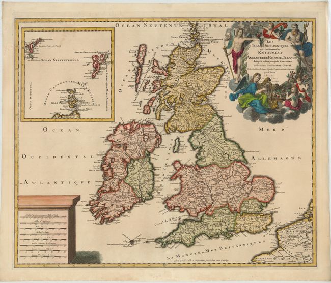
“Les Isles Britanniques; qui Contiennent les Royaumes d'Angleterre, Escosse, et Irlande...”
Map Maker:
Valk [Family]
Valck's map of the British Isles follows closely t... (full text available to subscribers)
| Item Detail |
| |
| |
MapMaker: |
Valk [Family]
|
|
| |
| |
Subject: |
Britain |
|
| |
Period/Size: |
1695 / 19.0" x 22.8" (48.3 x 58.0 cm)
|
|
| |
Color: |
Colored
|
|
| |
Condition: |
(A ) A nice impression on watermarked paper with a professionally repaired centerfold separation that enters 2.5" into map at bottom. There is a chip along centerfold in bottom blank margin that has also been professionally repaired. (condition help) |
|
| |
Source: |
|
|
| |
References: |
Shirley (BI to 1750) Valck 1. |
|
| |
|
|
| Sales Information |
| |
| |
Price: |
|
|
| |
| |
Offered by: |
Old World Auctions |
|
| |
Catalog: |
Auction No. 142 - Antique Maps, Charts, Atlases & Globes (9038) |
|
| |
Lot/Item #: |
404 |
|
| |
| |
Date: |
12/2012
|
|
| |
| |
|
Antique Maps - Valuation and Pricing, Descriptions, Resources |
|
Home |
Information |
Search |
Register |
Contact Us |
Site Map
Americana Exchange, Inc. © 1999 - 2024 Americana Exchange, Inc.. All rights reserved.
OldMaps.com, the OldMaps.com logo and
AMPR are service marks or registered service marks of Americana Exchange, Inc..
|