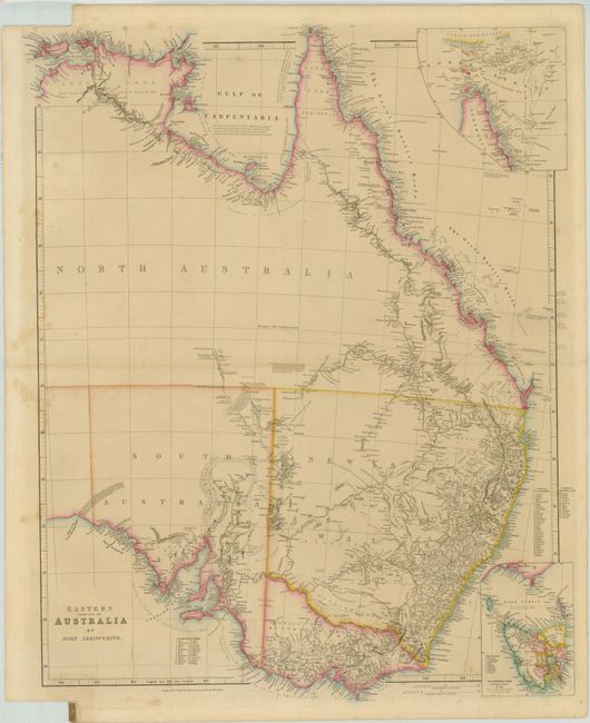
Title:
“Eastern Portion of Australia”
Map Maker:
John Arrowsmith
Arrowsmith’s map of Eastern Australia, published b... (full text available to subscribers)
| Item Detail |
| |
| |
MapMaker: |
John Arrowsmith
|
|
| |
| |
Subject: |
Australia |
|
| |
Period/Size: |
1850 / 25.3" x 19.3" (64.3 x 49.1 cm)
|
|
| |
Color: |
Colored
|
|
| |
Condition: |
(B+ ) Original outline color. There are a few light spots mostly in the blank margins. Binding trim at lower left with a titled atlas tab. (condition help) |
|
| |
Source: |
The London Atlas of Universal Geography |
|
| |
References: |
Tooley (Aust) #85; Prescott (http://www.asmp.esrc.unimelb.edu.au/). |
|
| |
|
|
| Sales Information |
| |
| |
Price: |
|
|
| |
| |
Offered by: |
Old World Auctions |
|
| |
Catalog: |
Auction No. 142 - Antique Maps, Charts, Atlases & Globes (9038) |
|
| |
Lot/Item #: |
707 |
|
| |
| |
Date: |
12/2012
|
|
| |
| |
|
Antique Maps - Valuation and Pricing, Descriptions, Resources |
|
Home |
Information |
Search |
Register |
Contact Us |
Site Map
Americana Exchange, Inc. © 1999 - 2024 Americana Exchange, Inc.. All rights reserved.
OldMaps.com, the OldMaps.com logo and
AMPR are service marks or registered service marks of Americana Exchange, Inc..
|