Title:
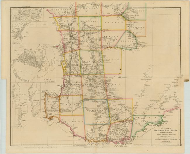
“The Colony of Western Australia from the Surveys of John Septimus Roe Esqr. Surveyor Genl. and from other Official Documents in the Colonial Office and Admiralty”
Map Maker:
John Arrowsmith
This incredibly detailed map of Western Australia ... (full text available to subscribers)
| Item Detail |
| |
| |
MapMaker: |
John Arrowsmith
|
|
| |
| |
Subject: |
Australia |
|
| |
Period/Size: |
1850 / 20.5" x 24.0" (52.1 x 61.0 cm)
|
|
| |
Color: |
Colored
|
|
| |
Condition: |
(B+ ) Original outline color. There is a small area of toning at right resulting from the atlas page tab on verso and a short fold separation in the bottom blank margin. (condition help) |
|
| |
Source: |
The London Atlas of Universal Geography |
|
| |
References: |
Tooley (Aust) #130; Prescott (http://www.asmp.esrc.unimelb.edu.au/). |
|
| |
|
|
| Sales Information |
| |
| |
Price: |
|
|
| |
| |
Offered by: |
Old World Auctions |
|
| |
Catalog: |
Auction No. 142 - Antique Maps, Charts, Atlases & Globes (9038) |
|
| |
Lot/Item #: |
708 |
|
| |
| |
Date: |
12/2012
|
|
| |
| |
|
Antique Maps - Valuation and Pricing, Descriptions, Resources |
|
Home |
Information |
Search |
Register |
Contact Us |
Site Map
Americana Exchange, Inc. © 1999 - 2024 Americana Exchange, Inc.. All rights reserved.
OldMaps.com, the OldMaps.com logo and
AMPR are service marks or registered service marks of Americana Exchange, Inc..
|