Title:
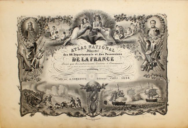
“Atlas National Illustre des 86 Departements et des Possessions de la France Divise par Arrondissements, Cantons, et Communes...”
Map Maker:
Victor Levasseur
This was one of the last decorative atlases ever p... (full text available to subscribers)
| Item Detail |
| |
| |
MapMaker: |
Victor Levasseur
|
|
| |
| |
Subject: |
Atlases |
|
| |
Period/Size: |
1856 / 20.8" x 14.3" (52.9 x 36.4 cm)
|
|
| |
Color: |
Colored
|
|
| |
Condition: |
(B+ ) The maps all have original color, and the vast majority are in fine or near fine condition. The map of France has light, scattered foxing, and the world and continents maps each have a couple of spots of foxing. The binding is somewhat loose and (condition help) |
|
| |
Source: |
|
|
| |
References: |
|
|
| |
|
|
| Sales Information |
| |
| |
Price: |
|
|
| |
| |
Offered by: |
Old World Auctions |
|
| |
Catalog: |
Auction No. 142 - Antique Maps, Charts, Atlases & Globes (9038) |
|
| |
Lot/Item #: |
761 |
|
| |
| |
Date: |
12/2012
|
|
| |
| |
|
Antique Maps - Valuation and Pricing, Descriptions, Resources |
|
Home |
Information |
Search |
Register |
Contact Us |
Site Map
Americana Exchange, Inc. © 1999 - 2024 Americana Exchange, Inc.. All rights reserved.
OldMaps.com, the OldMaps.com logo and
AMPR are service marks or registered service marks of Americana Exchange, Inc..
|