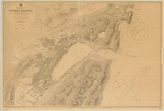
Title:
“St. John's Harbour…”
Map Maker:
Canadian Government
This large, detailed chart of St. John's Harbor is... (full text available to subscribers)
| Item Detail |
| |
| |
MapMaker: |
Canadian Government
|
|
| |
| |
Subject: |
Newfoundland, Canada |
|
| |
Period/Size: |
1960 / 26.3" x 39.0" (66.8 x 99.1 cm)
|
|
| |
Color: |
Black & White
|
|
| |
Condition: |
(B+ ) Moderate even-age toning with one tiny ink notation in the image and a few minor crumples in the blank margins. Remnants of paper tape along the edges of the sheet on verso. (condition help) |
|
| |
Source: |
|
|
| |
References: |
|
|
| |
|
|
| Sales Information |
| |
| |
Price: |
|
|
| |
| |
Offered by: |
Old World Auctions |
|
| |
Catalog: |
Auction No. 141 - Antique Maps, Charts, Atlases & Globes (9037) |
|
| |
Lot/Item #: |
125 |
|
| |
| |
Date: |
09/2012
|
|
| |
| |
|
Antique Maps - Valuation and Pricing, Descriptions, Resources |
|
Home |
Information |
Search |
Register |
Contact Us |
Site Map
Americana Exchange, Inc. © 1999 - 2024 Americana Exchange, Inc.. All rights reserved.
OldMaps.com, the OldMaps.com logo and
AMPR are service marks or registered service marks of Americana Exchange, Inc..
|