|
|
||
Title:
“Carte Topographique des Pays et Cotes Maritimes qui Forment le Detroit de Gibraltar / Topographische Carte der Lander und Kusten Welche die Meer Enge von Gibraltar”
Map Maker:
Homann Heirs
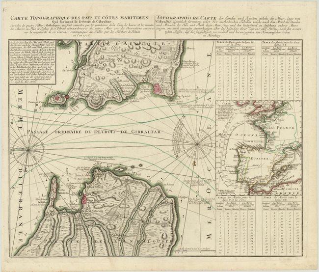
The strategic Strait of Gibraltar is the focus of ... (full text available to subscribers)
|
|
|||||||||||||||||||||||||||||||||||||||||||||||||||||||||||||||||||||||||||||||||||||||||
Antique Maps - Valuation and Pricing, Descriptions, Resources | ||||||||||||||||||||||||||||||||||||||||||||||||||||||||||||||||||||||||||||||||||||||||||
|
Home |
Information |
Search |
Register |
Contact Us |
Site Map
Americana Exchange, Inc. © 1999 - 2024 Americana Exchange, Inc.. All rights reserved.
OldMaps.com, the OldMaps.com logo and |