Title:
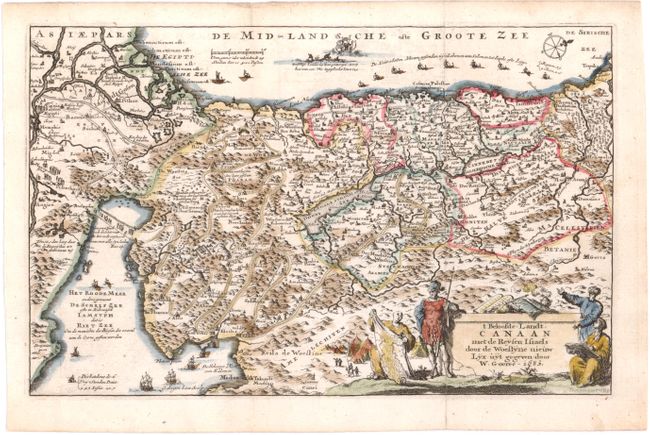
“T Beloofde, Landt, Canaan met de Reysen Israels door de Woestyne…”
Map Maker:
Goeree [Family]
This map depicting the Exodus from Egypt and the w... (full text available to subscribers)
| Item Detail |
| |
| |
MapMaker: |
Goeree [Family]
|
|
| |
| |
Subject: |
Holy Land |
|
| |
Period/Size: |
1683 / 5.2" x 8.3" (13.2 x 21.1 cm)
|
|
| |
Color: |
Colored
|
|
| |
Condition: |
(A ) Issued folding, now pressed with short fold separations in blank margins that have been professionally repaired. (condition help) |
|
| |
Source: |
De Republyk der Hebreen |
|
| |
References: |
Laor #303. |
|
| |
|
|
| Sales Information |
| |
| |
Price: |
|
|
| |
| |
Offered by: |
Old World Auctions |
|
| |
Catalog: |
Auction No. 142 - Antique Maps, Charts, Atlases & Globes (9038) |
|
| |
Lot/Item #: |
611 |
|
| |
| |
Date: |
12/2012
|
|
| |
| |
|
Antique Maps - Valuation and Pricing, Descriptions, Resources |
|
Home |
Information |
Search |
Register |
Contact Us |
Site Map
Americana Exchange, Inc. © 1999 - 2024 Americana Exchange, Inc.. All rights reserved.
OldMaps.com, the OldMaps.com logo and
AMPR are service marks or registered service marks of Americana Exchange, Inc..
|