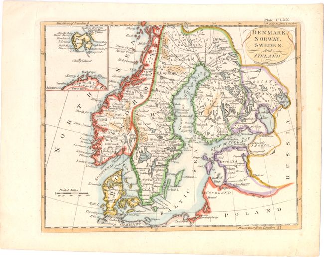
Title:
“Denmark, Norway, Sweden, and Finland”
Map Maker:
Andrew Bell
A nice map of Norway, Sweden, Finland, and Denmark... (full text available to subscribers)
| Item Detail |
| |
| |
MapMaker: |
Andrew Bell
|
|
| |
| |
Subject: |
Scandinavia |
|
| |
Period/Size: |
1790 / 6.7" x 8.4" (17.1 x 21.4 cm)
|
|
| |
Color: |
Colored
|
|
| |
Condition: |
(A) One small tear in bottom blank margin, far from map image, has been closed in archival tape. (condition help) |
|
| |
Source: |
|
|
| |
References: |
|
|
| |
|
|
| Sales Information |
| |
| |
Price: |
|
|
| |
| |
Offered by: |
Old World Auctions |
|
| |
Catalog: |
Auction No. 143 - Antique Maps, Charts, Atlases & Globes (9042) |
|
| |
Lot/Item #: |
474 |
|
| |
| |
Date: |
02/2013
|
|
| |
| |
|
Antique Maps - Valuation and Pricing, Descriptions, Resources |
|
Home |
Information |
Search |
Register |
Contact Us |
Site Map
Americana Exchange, Inc. © 1999 - 2024 Americana Exchange, Inc.. All rights reserved.
OldMaps.com, the OldMaps.com logo and
AMPR are service marks or registered service marks of Americana Exchange, Inc..
|