Title:
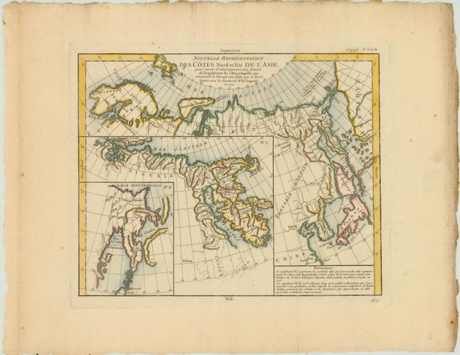
“Nouvelle Representation des Cotes Nord et Est de l'Asie pour servir d'eclaircissement aux Articles du Supplement de l'Encyclopedie qui concernent le Passage aux Indes par le Nord”
Map Maker:
Gilles Robert de Vaugondy
Interesting map of the northeast coast of Asia dep... (full text available to subscribers)
| Item Detail |
| |
| |
MapMaker: |
Gilles Robert de Vaugondy
|
|
| |
| |
Subject: |
Northern Asia |
|
| |
Period/Size: |
1772 / 11.7" x 15.2" (29.8 x 38.6 cm)
|
|
| |
Color: |
Colored
|
|
| |
Condition: |
(A) Watermarked paper with minor soiling in wide original margins. (condition help) |
|
| |
Source: |
Diderot's Encyclopedie (Supplement) |
|
| |
References: |
Pedley #402. |
|
| |
|
|
| Sales Information |
| |
| |
Price: |
|
|
| |
| |
Offered by: |
Old World Auctions |
|
| |
Catalog: |
Auction No. 143 - Antique Maps, Charts, Atlases & Globes (9042) |
|
| |
Lot/Item #: |
701 |
|
| |
| |
Date: |
02/2013
|
|
| |
| |
|
Antique Maps - Valuation and Pricing, Descriptions, Resources |
|
Home |
Information |
Search |
Register |
Contact Us |
Site Map
Americana Exchange, Inc. © 1999 - 2024 Americana Exchange, Inc.. All rights reserved.
OldMaps.com, the OldMaps.com logo and
AMPR are service marks or registered service marks of Americana Exchange, Inc..
|