Title:
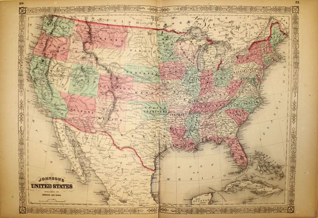
“Johnson's New Illustrated (Steel Plate) Family Atlas, with Physical Geography, and with Descriptions Geographical, Statistical, and Historical, Including the Latest Federal Census...”
Map Maker:
Johnson & Ward
This fine folio atlas includes the beautiful Am... (full text available to subscribers)
| Item Detail |
| |
| |
MapMaker: |
Johnson & Ward
|
|
| |
| |
Subject: |
Atlases |
|
| |
Period/Size: |
1865 / 18.7" x 15.0" (47.5 x 38.1 cm)
|
|
| |
Color: |
Colored
|
|
| |
Condition: |
(B+) Overall very good condition. Several maps have centerfold separations at bottom including the U.S. map (6") and the map of California, Utah and Nevada (5"). Maps have light toning and occasional minor foxing with the first 10 sheets showing small w (condition help) |
|
| |
Source: |
|
|
| |
References: |
|
|
| |
|
|
| Sales Information |
| |
| |
Price: |
|
|
| |
| |
Offered by: |
Old World Auctions |
|
| |
Catalog: |
Auction No. 143 - Antique Maps, Charts, Atlases & Globes (9042) |
|
| |
Lot/Item #: |
838 |
|
| |
| |
Date: |
02/2013
|
|
| |
| |
|
Antique Maps - Valuation and Pricing, Descriptions, Resources |
|
Home |
Information |
Search |
Register |
Contact Us |
Site Map
Americana Exchange, Inc. © 1999 - 2024 Americana Exchange, Inc.. All rights reserved.
OldMaps.com, the OldMaps.com logo and
AMPR are service marks or registered service marks of Americana Exchange, Inc..
|