Title:
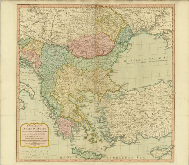
“A New Map of Turkey in Europe Divided into all its Provinces; with the Adjacent Countries in Europe and Asia: Drawn Chiefly from the Maps Published by the Imperial Academy of St. Petersburg”
Map Maker:
Laurie & Whittle
This sharply engraved map is based on information ... (full text available to subscribers)
| Item Detail |
| |
| |
MapMaker: |
Laurie & Whittle
|
|
| |
| |
Subject: |
Southeastern Europe |
|
| |
Period/Size: |
1794 / 23.7" x 23.8" (60.2 x 60.5 cm)
|
|
| |
Color: |
Colored
|
|
| |
Condition: |
(B) Original color on watermarked paper with archival repairs to two short tears adjacent to centerfold, light offsetting and toning, and some minor soiling confined to the upper blank margin. (condition help) |
|
| |
Source: |
Imperial Sheet Atlas |
|
| |
References: |
|
|
| |
|
|
| Sales Information |
| |
| |
Price: |
|
|
| |
| |
Offered by: |
Old World Auctions |
|
| |
Catalog: |
Auction No. 143 - Antique Maps, Charts, Atlases & Globes (9042) |
|
| |
Lot/Item #: |
595 |
|
| |
| |
Date: |
02/2013
|
|
| |
| |
|
Antique Maps - Valuation and Pricing, Descriptions, Resources |
|
Home |
Information |
Search |
Register |
Contact Us |
Site Map
Americana Exchange, Inc. © 1999 - 2024 Americana Exchange, Inc.. All rights reserved.
OldMaps.com, the OldMaps.com logo and
AMPR are service marks or registered service marks of Americana Exchange, Inc..
|