Title:
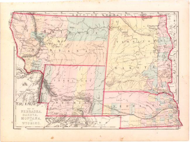
“Map of Nebraska, Dakota. Montana, and Wyoming”
Map Maker:
J. David Williams
Detailed and uncommon regional map hand colored by... (full text available to subscribers)
| Item Detail |
| |
| |
MapMaker: |
J. David Williams
|
|
| |
| |
Subject: |
Central United States |
|
| |
Period/Size: |
1875 / 12.2" x 17.2" (31.0 x 43.7 cm)
|
|
| |
Color: |
Colored
|
|
| |
Condition: |
(B+) A few unobtrusive spots and one tear in left blank margin that has been repaired on recto with archival tape. (condition help) |
|
| |
Source: |
|
|
| |
References: |
|
|
| |
|
|
| Sales Information |
| |
| |
Price: |
|
|
| |
| |
Offered by: |
Old World Auctions |
|
| |
Catalog: |
Auction No. 143 - Antique Maps, Charts, Atlases & Globes (9042) |
|
| |
Lot/Item #: |
213 |
|
| |
| |
Date: |
02/2013
|
|
| |
| |
|
Antique Maps - Valuation and Pricing, Descriptions, Resources |
|
Home |
Information |
Search |
Register |
Contact Us |
Site Map
Americana Exchange, Inc. © 1999 - 2024 Americana Exchange, Inc.. All rights reserved.
OldMaps.com, the OldMaps.com logo and
AMPR are service marks or registered service marks of Americana Exchange, Inc..
|