Title:
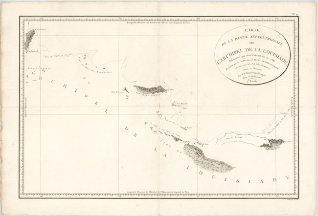
“Carte de la Partie Septentrionale de l'Archipel de la Louisiade, Decouvert par Bougainville, en 1768...”
Map Maker:
Charles Francois Beautemps-Beaupre
Rarely seen map showing, in great detail, the area... (full text available to subscribers)
| Item Detail |
| |
| |
MapMaker: |
Charles Francois Beautemps-Beaupre
|
|
| |
| |
Subject: |
East Indies - Papua New Guinea |
|
| |
Period/Size: |
1798 / 19.5" x 29.8" (49.6 x 75.7 cm)
|
|
| |
Color: |
Black & White
|
|
| |
Condition: |
(B) Light soiling with some small chips and tears confined to blank margins. A small centerfold separation at center has been backed in paper and two 0.5" tears in unengraved areas of the map have been archivally repaired. There is an extraneous horizon (condition help) |
|
| |
Source: |
Atlas du Voyage de Bruny-Dentrecasteaux en 1792 et 1793 |
|
| |
References: |
|
|
| |
|
|
| Sales Information |
| |
| |
Price: |
|
|
| |
| |
Offered by: |
Old World Auctions |
|
| |
Catalog: |
Auction No. 143 - Antique Maps, Charts, Atlases & Globes (9042) |
|
| |
Lot/Item #: |
732 |
|
| |
| |
Date: |
02/2013
|
|
| |
| |
|
Antique Maps - Valuation and Pricing, Descriptions, Resources |
|
Home |
Information |
Search |
Register |
Contact Us |
Site Map
Americana Exchange, Inc. © 1999 - 2024 Americana Exchange, Inc.. All rights reserved.
OldMaps.com, the OldMaps.com logo and
AMPR are service marks or registered service marks of Americana Exchange, Inc..
|