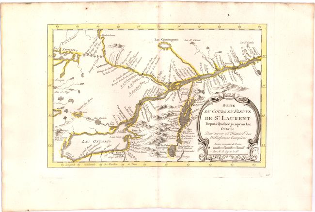
Title:
“Suite du Cours du Fleuve de St. Laurent Depuis Quebec Jusqu'au Lac Ontario pour Servir a l'Histoire des Etablissemens Europeens”
Map Maker:
Jacques Nicolas Bellin
A detailed map of the region between Lake Ontario ... (full text available to subscribers)
| Item Detail |
| |
| |
MapMaker: |
Jacques Nicolas Bellin
|
|
| |
| |
Subject: |
Colonial Lake Ontario & St. Lawrence River |
|
| |
Period/Size: |
1773 / 7.2" x 11.0" (18.3 x 28.0 cm)
|
|
| |
Color: |
Colored
|
|
| |
Condition: |
(A) Original color on watermarked paper with wide margins and a few small, unobtrusive spots. (condition help) |
|
| |
Source: |
Raynal's Atlas Portatif |
|
| |
References: |
Kershaw #634. |
|
| |
|
|
| Sales Information |
| |
| |
Price: |
|
|
| |
| |
Offered by: |
Old World Auctions |
|
| |
Catalog: |
Auction No. 143 - Antique Maps, Charts, Atlases & Globes (9042) |
|
| |
Lot/Item #: |
162 |
|
| |
| |
Date: |
02/2013
|
|
| |
| |
|
Antique Maps - Valuation and Pricing, Descriptions, Resources |
|
Home |
Information |
Search |
Register |
Contact Us |
Site Map
Americana Exchange, Inc. © 1999 - 2024 Americana Exchange, Inc.. All rights reserved.
OldMaps.com, the OldMaps.com logo and
AMPR are service marks or registered service marks of Americana Exchange, Inc..
|