Title:
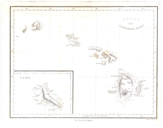
“Chart of the Sandwich Isles”
Map Maker:
Harper & Brothers
This example names each of the Hawaiian islands, a... (full text available to subscribers)
| Item Detail |
| |
| |
MapMaker: |
Harper & Brothers
|
|
| |
| |
Subject: |
Hawaii |
|
| |
Period/Size: |
1833 / 7.1" x 9.3" (18.1 x 23.7 cm)
|
|
| |
Color: |
Black & White
|
|
| |
Condition: |
(B+) Issued folding with some light foxing and a binding trim at lower right margin that has been replaced with old paper. An extraneous crease runs through top of map. (condition help) |
|
| |
Source: |
|
|
| |
References: |
|
|
| |
|
|
| Sales Information |
| |
| |
Price: |
|
|
| |
| |
Offered by: |
Old World Auctions |
|
| |
Catalog: |
Auction No. 143 - Antique Maps, Charts, Atlases & Globes (9042) |
|
| |
Lot/Item #: |
241 |
|
| |
| |
Date: |
02/2013
|
|
| |
| |
|
Antique Maps - Valuation and Pricing, Descriptions, Resources |
|
Home |
Information |
Search |
Register |
Contact Us |
Site Map
Americana Exchange, Inc. © 1999 - 2024 Americana Exchange, Inc.. All rights reserved.
OldMaps.com, the OldMaps.com logo and
AMPR are service marks or registered service marks of Americana Exchange, Inc..
|