Title:
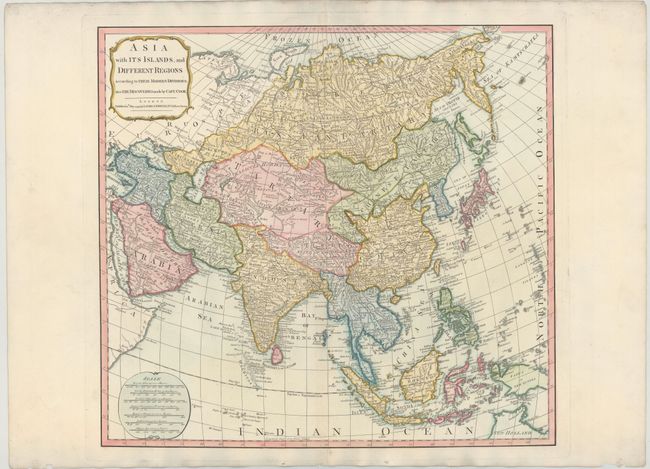
“Asia with its Islands, and Different Regions According to Their Modern Divisions; also the Discoveries Made by Capt. Cook”
Map Maker:
Laurie & Whittle
A handsome map of the continent extending from the... (full text available to subscribers)
| Item Detail |
| |
| |
MapMaker: |
Laurie & Whittle
|
|
| |
| |
Subject: |
Asia |
|
| |
Period/Size: |
1799 / 18.5" x 20.0" (47.0 x 50.8 cm)
|
|
| |
Color: |
Colored
|
|
| |
Condition: |
(B+) Watermarked paper ("J. Whatman 1808") with nice color and some faint toning along centerfold. Three tiny holes in bottom blank margin have been backed in tissue. (condition help) |
|
| |
Source: |
A New and Elegant Imperial Sheet Atlasģ |
|
| |
References: |
|
|
| |
|
|
| Sales Information |
| |
| |
Price: |
|
|
| |
| |
Offered by: |
Old World Auctions |
|
| |
Catalog: |
Auction No. 143 - Antique Maps, Charts, Atlases & Globes (9042) |
|
| |
Lot/Item #: |
696 |
|
| |
| |
Date: |
02/2013
|
|
| |
| |
|
Antique Maps - Valuation and Pricing, Descriptions, Resources |
|
Home |
Information |
Search |
Register |
Contact Us |
Site Map
Americana Exchange, Inc. © 1999 - 2024 Americana Exchange, Inc.. All rights reserved.
OldMaps.com, the OldMaps.com logo and
AMPR are service marks or registered service marks of Americana Exchange, Inc..
|