| Item Detail |
| |
| |
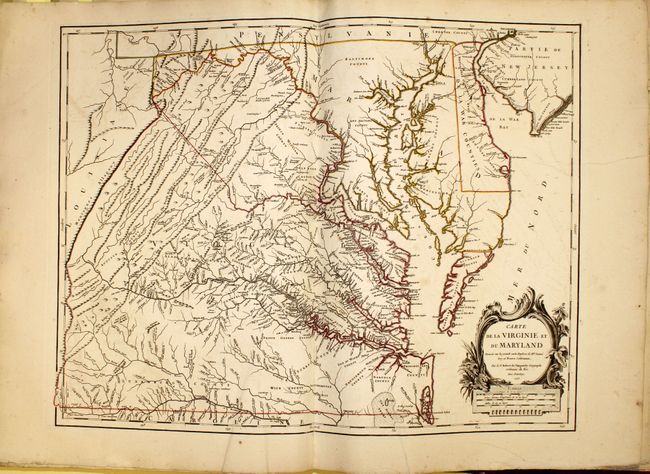
MapMaker: |
Robert de Vaugondy [Family]
|
|
| |
| |
Subject: |
Atlases |
|
| |
Period/Size: |
1757 / 22.5" x 18.0" (57.2 x 45.8 cm)
|
|
| |
Color: |
Colored
|
|
| |
Condition: |
(B+) The maps are generally in very good condition with original outline color and light toning, light scattered foxing, and occasional offsetting. A few maps have repairs to centerfold, three maps have tears ranging from 1" to 8" in the image (Virginia (condition help) |
|
| |
Source: |
|
|
| |
References: |
Pedley, pp. 51-68; Mickwitz & Miekkavaara #245. |
|
| |
|
|
| Sales Information |
| |
| |
Price: |
|
|
| |
| |
Offered by: |
Old World Auctions |
|
| |
Catalog: |
Auction No. 143 - Antique Maps, Charts, Atlases & Globes (9042) |
|
| |
Lot/Item #: |
827 |
|
| |
| |
Date: |
02/2013
|
|
| |
| |
|