| Item Detail |
| |
| |
MapMaker: |
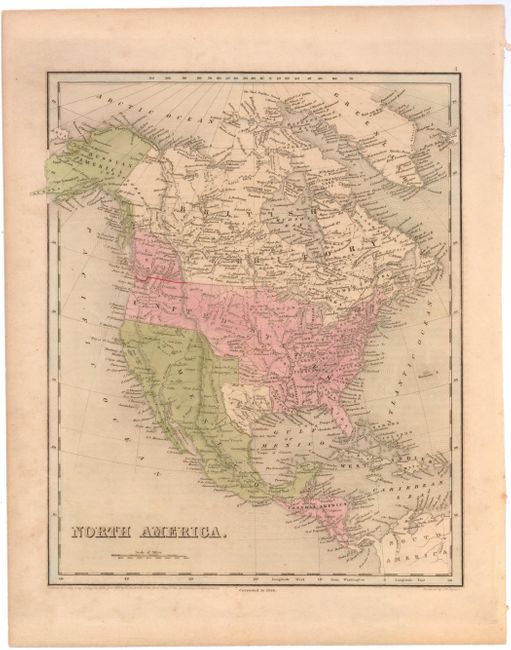
Thomas Gamaliel Bradford
|
|
| |
| |
Subject: |
North America |
|
| |
Period/Size: |
1846 / 14.2" x 11.5" (36.1 x 29.3 cm)
|
|
| |
Color: |
Colored
|
|
| |
Condition: |
(B) Toned with scattered foxing and one tiny pinhole only visible when held to light. The final boundary between the United States and Canada has been drawn in red ink. (condition help) |
|
| |
Source: |
|
|
| |
References: |
|
|
| |
|
|
| Sales Information |
| |
| |
Price: |
|
|
| |
| |
Offered by: |
Old World Auctions |
|
| |
Catalog: |
Auction No. 144 - Antique Maps, Charts, Atlases & Globes (9203) |
|
| |
Lot/Item #: |
37 |
|
| |
| |
Date: |
04/2013
|
|
| |
| |
|