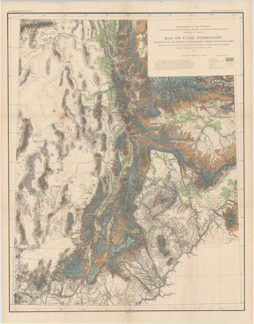
Title:
“Map of Utah Territory Representing the Extent of the Irrigable, Timber and Pasture Lands”
Map Maker:
U.S. Department of Interior
A colorful, graphic map that shows the populated r... (full text available to subscribers)
| Item Detail |
| |
| |
MapMaker: |
U.S. Department of Interior
|
|
| |
| |
Subject: |
Utah |
|
| |
Period/Size: |
1878 / 36.0" x 28.5" (91.5 x 72.4 cm)
|
|
| |
Color: |
Colored
|
|
| |
Condition: |
(B+) There are a number of short splits at fold intersections and some very faint offsetting in the image. There is one small brown stain to the southwest of the Great Salt Lake and a few additional fold separations confined to the blank margins. (condition help) |
|
| |
Source: |
HR Doc 73, 45th Cong., 2nd Sess. |
|
| |
References: |
Moffat #151; Wheat #1290. |
|
| |
|
|
| Sales Information |
| |
| |
Price: |
|
|
| |
| |
Offered by: |
Old World Auctions |
|
| |
Catalog: |
Auction No. 143 - Antique Maps, Charts, Atlases & Globes (9042) |
|
| |
Lot/Item #: |
299 |
|
| |
| |
Date: |
02/2013
|
|
| |
| |
|
Antique Maps - Valuation and Pricing, Descriptions, Resources |
|
Home |
Information |
Search |
Register |
Contact Us |
Site Map
Americana Exchange, Inc. © 1999 - 2024 Americana Exchange, Inc.. All rights reserved.
OldMaps.com, the OldMaps.com logo and
AMPR are service marks or registered service marks of Americana Exchange, Inc..
|