Title:
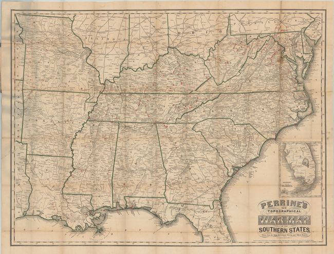
“Perrine's New Topographical War Map of the Southern States. Taken from the Latest Government Surveys and Official Reports”
Map Maker:
Charles O. Perrine
This large folding map of the Southern States is f... (full text available to subscribers)
| Item Detail |
| |
| |
MapMaker: |
Charles O. Perrine
|
|
| |
| |
Subject: |
Southern United States |
|
| |
Period/Size: |
1863 / 28.0" x 36.5" (71.2 x 92.8 cm)
|
|
| |
Color: |
Colored
|
|
| |
Condition: |
(B) The map is lightly toned with several small brown spots and a number of small centerfold separations that have been closed on verso with archival material. Paper boards are heavily worn and held together with archival tape. (condition help) |
|
| |
Source: |
|
|
| |
References: |
|
|
| |
|
|
| Sales Information |
| |
| |
Price: |
|
|
| |
| |
Offered by: |
Old World Auctions |
|
| |
Catalog: |
Auction No. 143 - Antique Maps, Charts, Atlases & Globes (9042) |
|
| |
Lot/Item #: |
208 |
|
| |
| |
Date: |
02/2013
|
|
| |
| |
|
Antique Maps - Valuation and Pricing, Descriptions, Resources |
|
Home |
Information |
Search |
Register |
Contact Us |
Site Map
Americana Exchange, Inc. © 1999 - 2024 Americana Exchange, Inc.. All rights reserved.
OldMaps.com, the OldMaps.com logo and
AMPR are service marks or registered service marks of Americana Exchange, Inc..
|