| Item Detail |
| |
| |
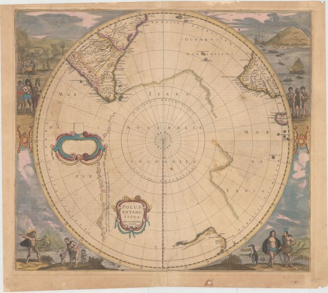
MapMaker: |
Henricus Hondius
|
|
| |
| |
Subject: |
South Pole |
|
| |
Period/Size: |
1641 / 17.0" x 19.5" (43.2 x 49.6 cm)
|
|
| |
Color: |
Colored
|
|
| |
Condition: |
(B) Original color with light scattered foxing, faint text show through, and one tiny wormhole in image. There is an archivally repaired tear that enters 1.5" into image at bottom adjacent to centerfold, and a tiny hole confined to the lower blank margin (condition help) |
|
| |
Source: |
|
|
| |
References: |
Tooley (MCC -2) #20; Tooley (Australia) #726. |
|
| |
|
|
| Sales Information |
| |
| |
Price: |
|
|
| |
| |
Offered by: |
Old World Auctions |
|
| |
Catalog: |
Auction No. 143 - Antique Maps, Charts, Atlases & Globes (9042) |
|
| |
Lot/Item #: |
69 |
|
| |
| |
Date: |
02/2013
|
|
| |
| |
|