Title:
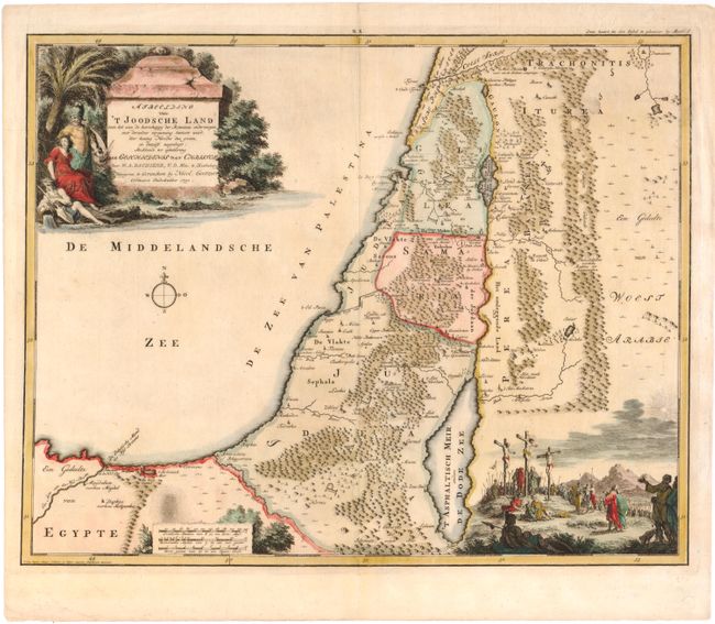
“Afbeelding van 't Joodsche Land toen het aan de Heerschappy der Romeinen Onderworpen...”
Map Maker:
Willem Albert Bachiene
This attractive map shows the land of Israel with ... (full text available to subscribers)
| Item Detail |
| |
| |
MapMaker: |
Willem Albert Bachiene
|
|
| |
| |
Subject: |
Holy Land |
|
| |
Period/Size: |
1750 / 14.8" x 18.7" (37.6 x 47.5 cm)
|
|
| |
Color: |
Colored
|
|
| |
Condition: |
(A) (condition help) |
|
| |
Source: |
|
|
| |
References: |
Poortman & Augusteijn #185. |
|
| |
|
|
| Sales Information |
| |
| |
Price: |
|
|
| |
| |
Offered by: |
Old World Auctions |
|
| |
Catalog: |
Auction No. 143 - Antique Maps, Charts, Atlases & Globes (9042) |
|
| |
Lot/Item #: |
672 |
|
| |
| |
Date: |
02/2013
|
|
| |
| |
|
Antique Maps - Valuation and Pricing, Descriptions, Resources |
|
Home |
Information |
Search |
Register |
Contact Us |
Site Map
Americana Exchange, Inc. © 1999 - 2024 Americana Exchange, Inc.. All rights reserved.
OldMaps.com, the OldMaps.com logo and
AMPR are service marks or registered service marks of Americana Exchange, Inc..
|