| Item Detail |
| |
| |
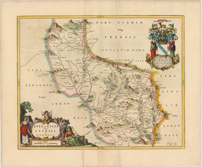
MapMaker: |
Johannes Blaeu
|
|
| |
| |
Subject: |
Southern Scotland |
|
| |
Period/Size: |
1654 / 16.6" x 20.7" (42.2 x 52.6 cm)
|
|
| |
Color: |
Colored
|
|
| |
Condition: |
(B+) Excellent coloring with two printer's creases parallel to centerfold, minor soiling, and show through of text on verso. Short centerfold separations in top and bottom blank margins have been backed in archival tape. (condition help) |
|
| |
Source: |
Theatrum Orbis Terrarum sive Atlas Novus |
|
| |
References: |
Phillips (A) 5941, v.5 #10. |
|
| |
|
|
| Sales Information |
| |
| |
Price: |
|
|
| |
| |
Offered by: |
Old World Auctions |
|
| |
Catalog: |
Auction No. 144 - Antique Maps, Charts, Atlases & Globes (9203) |
|
| |
Lot/Item #: |
160 |
|
| |
| |
Date: |
04/2013
|
|
| |
| |
|