| Item Detail |
| |
| |
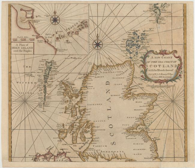
MapMaker: |
Mount & Page
|
|
| |
| |
Subject: |
Scotland |
|
| |
Period/Size: |
1771 / 18.5" x 21.0" (47.0 x 53.4 cm)
|
|
| |
Color: |
Colored
|
|
| |
Condition: |
(B) Issued folding, now pressed, with professional repairs to several fold separations and some tiny holes. There is light soiling, a bit of scattered foxing, and numerous tiny abrasions. Remargined at bottom with old paper to accommodate framing. (condition help) |
|
| |
Source: |
The English Pilot, the Southern Navigation |
|
| |
References: |
Shirley (BL Atlases) M.M&P-1d #4. |
|
| |
|
|
| Sales Information |
| |
| |
Price: |
|
|
| |
| |
Offered by: |
Old World Auctions |
|
| |
Catalog: |
Auction No. 144 - Antique Maps, Charts, Atlases & Globes (9203) |
|
| |
Lot/Item #: |
159 |
|
| |
| |
Date: |
04/2013
|
|
| |
| |
|