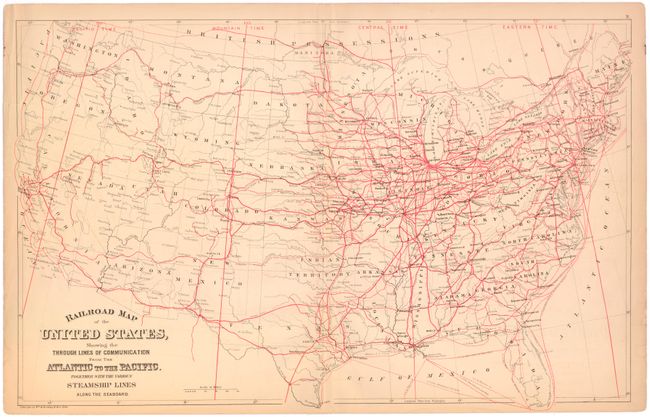
Title:
“Railroad Map of the United States, Showing the through Lines of Communication from the Atlantic to the Pacific. Together with the Various Steamship Lines along the Seaboard”
Map Maker:
Mitchell/Bradley
This map shows both completed and proposed railroa... (full text available to subscribers)
| Item Detail |
| |
| |
MapMaker: |
Mitchell/Bradley
|
|
| |
| |
Subject: |
United States, Railroads |
|
| |
Period/Size: |
1884 / 14.2" x 22.6" (36.1 x 57.4 cm)
|
|
| |
Color: |
Colored
|
|
| |
Condition: |
(B) Light toning and offsetting with some minor chips and tears confined to the left blank margin that have been closed on verso with archival tape. (condition help) |
|
| |
Source: |
|
|
| |
References: |
|
|
| |
|
|
| Sales Information |
| |
| |
Price: |
|
|
| |
| |
Offered by: |
Old World Auctions |
|
| |
Catalog: |
Auction No. 144 - Antique Maps, Charts, Atlases & Globes (9203) |
|
| |
Lot/Item #: |
55 |
|
| |
| |
Date: |
04/2013
|
|
| |
| |
|
Antique Maps - Valuation and Pricing, Descriptions, Resources |
|
Home |
Information |
Search |
Register |
Contact Us |
Site Map
Americana Exchange, Inc. © 1999 - 2024 Americana Exchange, Inc.. All rights reserved.
OldMaps.com, the OldMaps.com logo and
AMPR are service marks or registered service marks of Americana Exchange, Inc..
|