Title:
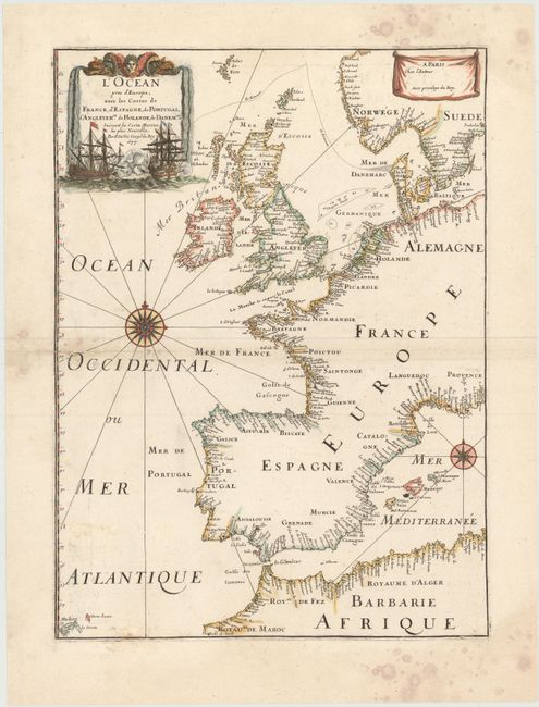
“L'Ocean pres d'Europe, avec les Costes de France, d'Espagne, de Portugal, d'Angleterre, de Holande, de Danemarc & suivant les Cartes Marines les plus Nouvelles”
Map Maker:
Pierre Duval
Very handsome chart by a famous 18th century carto... (full text available to subscribers)
| Item Detail |
| |
| |
MapMaker: |
Pierre Duval
|
|
| |
| |
Subject: |
Western Europe |
|
| |
Period/Size: |
1677 / 18.5" x 13.3" (47.0 x 33.8 cm)
|
|
| |
Color: |
Colored
|
|
| |
Condition: |
(B) Attractive color on watermarked paper and damp stains primarily confined to blank margins. There are professional repairs to a centerfold separation at left with an adjacent 2" tear in image and small chip in blank margin. (condition help) |
|
| |
Source: |
Cartes de Geographie les plus Nouvelles… |
|
| |
References: |
Pastoureau, DUVAL II D. |
|
| |
|
|
| Sales Information |
| |
| |
Price: |
|
|
| |
| |
Offered by: |
Old World Auctions |
|
| |
Catalog: |
Auction No. 144 - Antique Maps, Charts, Atlases & Globes (9203) |
|
| |
Lot/Item #: |
173 |
|
| |
| |
Date: |
04/2013
|
|
| |
| |
|
Antique Maps - Valuation and Pricing, Descriptions, Resources |
|
Home |
Information |
Search |
Register |
Contact Us |
Site Map
Americana Exchange, Inc. © 1999 - 2024 Americana Exchange, Inc.. All rights reserved.
OldMaps.com, the OldMaps.com logo and
AMPR are service marks or registered service marks of Americana Exchange, Inc..
|