| Item Detail |
| |
| |
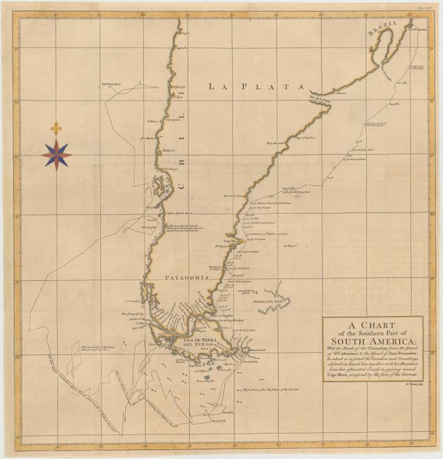
MapMaker: |
George Anson
|
|
| |
| |
Subject: |
Southern South America |
|
| |
Period/Size: |
1748 / 19.8" x 19.2" (50.3 x 48.8 cm)
|
|
| |
Color: |
Colored
|
|
| |
Condition: |
(B+) Issued folding, now pressed with some light offsetting, minor toning, and a few tiny holes at fold intersections that have been closed on verso with archival tape. A tear at left extending 3" into map image has been professionally repaired, and the (condition help) |
|
| |
Source: |
A Voyage Round the World |
|
| |
References: |
Shirley (BL Atlases) G.ANS-1a #2. |
|
| |
|
|
| Sales Information |
| |
| |
Price: |
|
|
| |
| |
Offered by: |
Old World Auctions |
|
| |
Catalog: |
Auction No. 144 - Antique Maps, Charts, Atlases & Globes (9203) |
|
| |
Lot/Item #: |
134 |
|
| |
| |
Date: |
04/2013
|
|
| |
| |
|