Title:
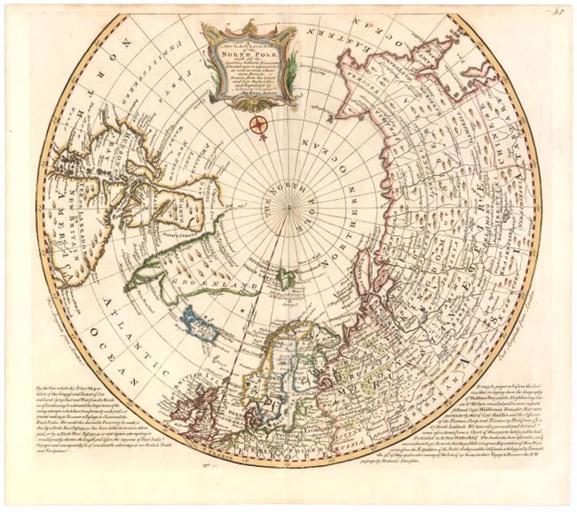
“A New & Accurate Map of the North Pole, with all the Countries Hitherto Discovered, Situated Near or Adjacent to it, as well as Some Others More Remote…”
Map Maker:
Emanuel Bowen
Handsome polar map covering the region north of 50... (full text available to subscribers)
| Item Detail |
| |
| |
MapMaker: |
Emanuel Bowen
|
|
| |
| |
Subject: |
North Pole |
|
| |
Period/Size: |
1747 / 15.0" x 16.0" (38.1 x 40.7 cm)
|
|
| |
Color: |
Colored
|
|
| |
Condition: |
(B+) Attractive color with a few small spots, a hint of toning along centerfold, and a printer's crease adjacent to centerfold. (condition help) |
|
| |
Source: |
A Complete System of Geography |
|
| |
References: |
Phillips (A) #603-70; Kershaw: #420; Shirley (BL Atlases) T.BOW-2a #70. |
|
| |
|
|
| Sales Information |
| |
| |
Price: |
|
|
| |
| |
Offered by: |
Old World Auctions |
|
| |
Catalog: |
Auction No. 144 - Antique Maps, Charts, Atlases & Globes (9203) |
|
| |
Lot/Item #: |
19 |
|
| |
| |
Date: |
04/2013
|
|
| |
| |
|
Antique Maps - Valuation and Pricing, Descriptions, Resources |
|
Home |
Information |
Search |
Register |
Contact Us |
Site Map
Americana Exchange, Inc. © 1999 - 2024 Americana Exchange, Inc.. All rights reserved.
OldMaps.com, the OldMaps.com logo and
AMPR are service marks or registered service marks of Americana Exchange, Inc..
|