| Item Detail |
| |
| |
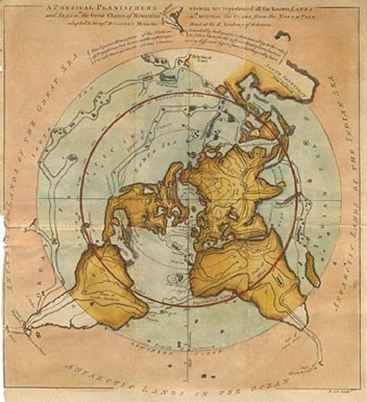
MapMaker: |
Benjamin Cole
|
|
| |
| |
Subject: |
Polar World |
|
| |
Period/Size: |
1757 / 12.4" x 11.5" (31.5 x 29.3 cm)
|
|
| |
Color: |
Colored
|
|
| |
Condition: |
(B) Unusual old color. Binding side margin trimmed nearly to neatline and torn into map with an old repair on verso. Very small hole by South America. (condition help) |
|
| |
Source: |
Gentleman's Magazine |
|
| |
References: |
Jolly GENT-104 |
|
| |
|
|
| Sales Information |
| |
| |
Price: |
|
|
| |
| |
Offered by: |
Old World Auctions |
|
| |
Catalog: |
Auction No. 96 - Antique Maps, Charts, Atlases & Globes (168) |
|
| |
Lot/Item #: |
055 |
|
| |
| |
Date: |
09/2001
|
|
| |
| |
|