Title:
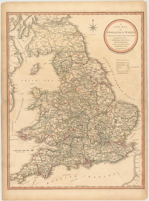
“A New Map of England & Wales, Compiled from the Actual Surveys of the Counties, and Regulated by the Latest Astronomical Observations; with the Turnpike Roads...”
Map Maker:
Richard Holmes Laurie
This detailed map of England and Wales depicts tow... (full text available to subscribers)
| Item Detail |
| |
| |
MapMaker: |
Richard Holmes Laurie
|
|
| |
| |
Subject: |
England & Wales |
|
| |
Period/Size: |
1820 / 25.5" x 19.8" (64.8 x 50.3 cm)
|
|
| |
Color: |
Colored
|
|
| |
Condition: |
(B) Original color with some offsetting and a few minute worm holes only visible when held to light. A long centerfold separation and several separations along the plate mark in blank margins have all been closed with archival tape. (condition help) |
|
| |
Source: |
|
|
| |
References: |
|
|
| |
|
|
| Sales Information |
| |
| |
Price: |
|
|
| |
| |
Offered by: |
Old World Auctions |
|
| |
Catalog: |
Auction No. 144 - Antique Maps, Charts, Atlases & Globes (9203) |
|
| |
Lot/Item #: |
158 |
|
| |
| |
Date: |
04/2013
|
|
| |
| |
|
Antique Maps - Valuation and Pricing, Descriptions, Resources |
|
Home |
Information |
Search |
Register |
Contact Us |
Site Map
Americana Exchange, Inc. © 1999 - 2024 Americana Exchange, Inc.. All rights reserved.
OldMaps.com, the OldMaps.com logo and
AMPR are service marks or registered service marks of Americana Exchange, Inc..
|