| Item Detail |
| |
| |
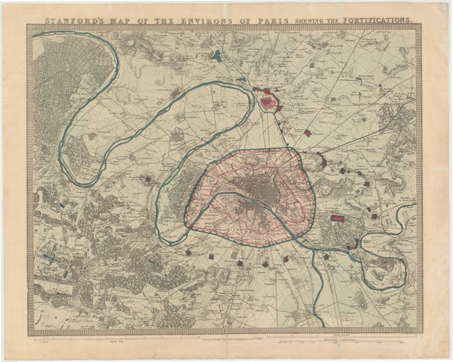
MapMaker: |
Edward Stanford
|
|
| |
| |
Subject: |
Paris, France |
|
| |
Period/Size: |
1870 / 17.8" x 23.0" (45.3 x 58.5 cm)
|
|
| |
Color: |
Colored
|
|
| |
Condition: |
(B+) Original color with archival repairs to several short centerfold separations both at top and bottom and also to a repaired tear at bottom right that enters 1" into the map. There is some light soiling, minor creasing and a few additional repaired te (condition help) |
|
| |
Source: |
|
|
| |
References: |
|
|
| |
|
|
| Sales Information |
| |
| |
Price: |
|
|
| |
| |
Offered by: |
Old World Auctions |
|
| |
Catalog: |
Auction No. 144 - Antique Maps, Charts, Atlases & Globes (9203) |
|
| |
Lot/Item #: |
181 |
|
| |
| |
Date: |
04/2013
|
|
| |
| |
|