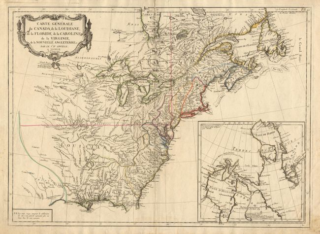
Title:
“Carte Generale du Canada, de la Louisiane, de la Floride, de la Caroline, de la Virginie, de la Nouvelle Angleterre etc.”
Map Maker:
Anville/Santini
Uncommon copper engraved map based on the cartogra... (full text available to subscribers)
| Item Detail |
| |
| |
MapMaker: |
Anville/Santini
|
|
| |
| |
Subject: |
Colonial North America |
|
| |
Period/Size: |
1776 / 18.8" x 25.7" (47.8 x 65.3 cm)
|
|
| |
Color: |
Colored
|
|
| |
Condition: |
(A) Beautifully engraved on thick hand-laid paper with watermark. Short split at top and bottom centerfold with no loss. Some foxing in margins. (condition help) |
|
| |
Source: |
|
|
| |
References: |
McKorkle #776.3; Sellers & Van Ee #136. |
|
| |
|
|
| Sales Information |
| |
| |
Price: |
|
|
| |
| |
Offered by: |
Old World Auctions |
|
| |
Catalog: |
Auction No. 96 - Antique Maps, Charts, Atlases & Globes (168) |
|
| |
Lot/Item #: |
121 |
|
| |
| |
Date: |
09/2001
|
|
| |
| |
|
Antique Maps - Valuation and Pricing, Descriptions, Resources |
|
Home |
Information |
Search |
Register |
Contact Us |
Site Map
Americana Exchange, Inc. © 1999 - 2024 Americana Exchange, Inc.. All rights reserved.
OldMaps.com, the OldMaps.com logo and
AMPR are service marks or registered service marks of Americana Exchange, Inc..
|