Title:
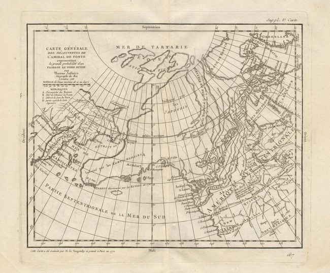
“Carte Generale des descouverte de l'Amiral de Fonte representant la grande probabilite d'un Passage au Nord Ouest par Thomas Jefferys Geographe de Roi a Londres 1768”
Map Maker:
Robert de Vaugondy [Family]
Probably the most extravagant of all the NORTHWEST... (full text available to subscribers)
| Item Detail |
| |
| |
MapMaker: |
Robert de Vaugondy [Family]
|
|
| |
| |
Subject: |
Western North America |
|
| |
Period/Size: |
1777 / 11.5" x 14.8" (29.3 x 37.6 cm)
|
|
| |
Color: |
Black & White
|
|
| |
Condition: |
(A) This example is a crisp impression on fine hand-laid paper with watermark and wide margins. Hint of offsetting that easily erases. (condition help) |
|
| |
Source: |
Diderot's Encyclopedea |
|
| |
References: |
Portinaro and Knirsch #159; Pedley #455; Hayes #36; Wagner (NW) #637. |
|
| |
|
|
| Sales Information |
| |
| |
Price: |
|
|
| |
| |
Offered by: |
Old World Auctions |
|
| |
Catalog: |
Auction No. 96 - Antique Maps, Charts, Atlases & Globes (168) |
|
| |
Lot/Item #: |
099 |
|
| |
| |
Date: |
09/2001
|
|
| |
| |
|
Antique Maps - Valuation and Pricing, Descriptions, Resources |
|
Home |
Information |
Search |
Register |
Contact Us |
Site Map
Americana Exchange, Inc. © 1999 - 2024 Americana Exchange, Inc.. All rights reserved.
OldMaps.com, the OldMaps.com logo and
AMPR are service marks or registered service marks of Americana Exchange, Inc..
|