Title:
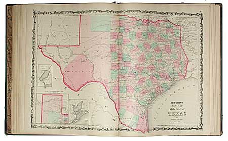
“Johnson's New Illustrated Family Atlas with physical geography, and with descriptions Geographical, Statistical, and Historical, including the Latest Federal Census..and History of the Civil War in America”
Map Maker:
Johnson & Ward
Complete atlas with about 65 steel engraved and ha... (full text available to subscribers)
| Item Detail |
| |
| |
MapMaker: |
Johnson & Ward
|
|
| |
| |
Subject: |
Atlas |
|
| |
Period/Size: |
1863 / 18.5" x 15.0" (47.0 x 38.1 cm)
|
|
| |
Color: |
Colored
|
|
| |
Condition: |
(A) Maps are fine with little or no foxing. Quarter green leather on spine. Cover is rubbed and detached at the front. Contents and are mostly tight and nicely aligned. A very nice example of this atlas that needs a little binding care. (condition help) |
|
| |
Source: |
|
|
| |
References: |
|
|
| |
|
|
| Sales Information |
| |
| |
Price: |
|
|
| |
| |
Offered by: |
Old World Auctions |
|
| |
Catalog: |
Auction No. 96 - Antique Maps, Charts, Atlases & Globes (168) |
|
| |
Lot/Item #: |
558 |
|
| |
| |
Date: |
09/2001
|
|
| |
| |
|
Antique Maps - Valuation and Pricing, Descriptions, Resources |
|
Home |
Information |
Search |
Register |
Contact Us |
Site Map
Americana Exchange, Inc. © 1999 - 2024 Americana Exchange, Inc.. All rights reserved.
OldMaps.com, the OldMaps.com logo and
AMPR are service marks or registered service marks of Americana Exchange, Inc..
|