Title:
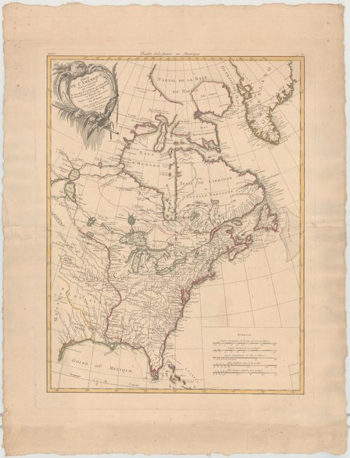
“Partie de l'Amerique Septentrionale, qui Comprend le Canada, la Louisiane, le Labrador, le Groenland, la Nouvelle Angleterre, la Floride &c.”
Map Maker:
Bonne/Lattre
Finely engraved Revolutionary War map cove... (full text available to subscribers)
| Item Detail |
| |
| |
MapMaker: |
Bonne/Lattre
|
|
| |
| |
Subject: |
Colonial United States & Canada |
|
| |
Period/Size: |
1776 / 22.5" x 17.0" (57.2 x 43.2 cm)
|
|
| |
Color: |
Colored
|
|
| |
Condition: |
(B+) On thick, watermarked paper with wide margins, a few tiny spots, and one faint stain above the distance scales. Deckle-edged. (condition help) |
|
| |
Source: |
Atlas Moderne |
|
| |
References: |
Kershaw #474; McCorkle #771.2. |
|
| |
|
|
| Sales Information |
| |
| |
Price: |
|
|
| |
| |
Offered by: |
Old World Auctions |
|
| |
Catalog: |
Auction No. 145 - Antique Maps, Charts, Atlases & Globes (9224) |
|
| |
Lot/Item #: |
133 |
|
| |
| |
Date: |
06/2013
|
|
| |
| |
|
Antique Maps - Valuation and Pricing, Descriptions, Resources |
|
Home |
Information |
Search |
Register |
Contact Us |
Site Map
Americana Exchange, Inc. © 1999 - 2024 Americana Exchange, Inc.. All rights reserved.
OldMaps.com, the OldMaps.com logo and
AMPR are service marks or registered service marks of Americana Exchange, Inc..
|