|
|
||
Title:
“A Map of the West-Indies &c. Mexico or New Spain. Also ye Trade Winds, and ye Several Tracts Made by ye Galeons and Flota from Place to Place”
Map Maker:
Herman Moll
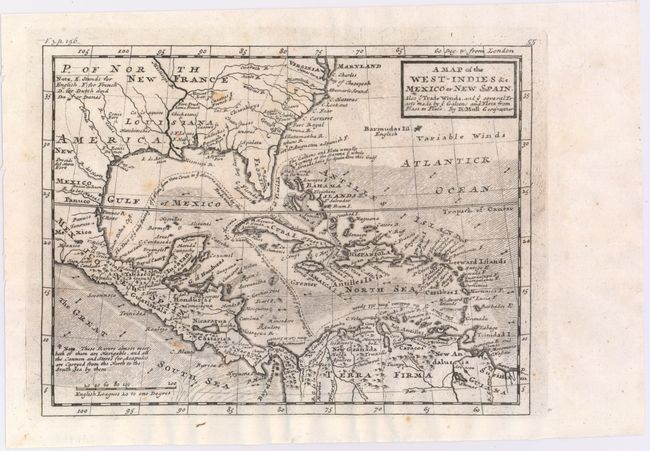
Terrific copper engraved map covering the southern... (full text available to subscribers)
|
|
|||||||||||||||||||||||||||||||||||||||||||||||||||||||||||||||||||||||||||||||||||||||||
Antique Maps - Valuation and Pricing, Descriptions, Resources | ||||||||||||||||||||||||||||||||||||||||||||||||||||||||||||||||||||||||||||||||||||||||||
|
Home |
Information |
Search |
Register |
Contact Us |
Site Map
Americana Exchange, Inc. © 1999 - 2024 Americana Exchange, Inc.. All rights reserved.
OldMaps.com, the OldMaps.com logo and |